El Camino Real

El Camino Real
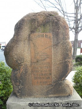
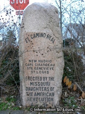
The oldest road in the State of Missouri was used by the Spanish, French and the Native Americans in the late 1700s and was called "El Camino Real" by the Spanish or "Rue Royale" by the French, both meaning "The Royal Road" or "The Kings Highway". It was a trail that ran from New Madrid and Sainte Genevieve to St Louis. Telegraph Road in South St Louis County is located on the path of El Camino Real. There are several red granite markers that were set up in 1917 by the Missouri Daughters of the American Revolution to mark the route of the El Camino Real. One marker is located in Kimmiswick Missouri and another is found in Sainte Genevieve. There are also markers found in Perryville, Cape Girardeau, and New Madrid Missouri.
El Camino Real Photo Gallery

El Camino Real marker in Ste Genevieve Missouri Link

El Camino Real marker in Cape Girardeau El Camino Real

El Camino Real marker in Benton Missouri, Scott County El Camino Real

Cape Girardeau El Camino Real marker El Camino Real

El Camino Real marker in Kimmswick Missouri Link

El Camino Real marker in New Madrid Missouri El Camino Real

El Camino Real marker in Kimmswick Missouri Link

El Camino Real marker in Benton MO, in front of the Scott County Missouri Courthouse El Camino Real

New Madrid El Camino Real Marker-still on the Kings Highway! El Camino Real
Hey There! Do You Know What Your Home Is Worth Today?
Check Here Now!Have You Considered A Career In Real Estate?
Learn MORE Here!St Louis Missouri Real Estate For Sale
New Construction For Sale: 1320
Condos For Sale: 697
Commercial For Sale: 1799
Acreage For Sale: 1263
Multi-Family 5+ For Sale: 103
Multi-Family 2-4 For Sale: 444
Lots For Sale: 3089
Total Properties For Sale: 18240

